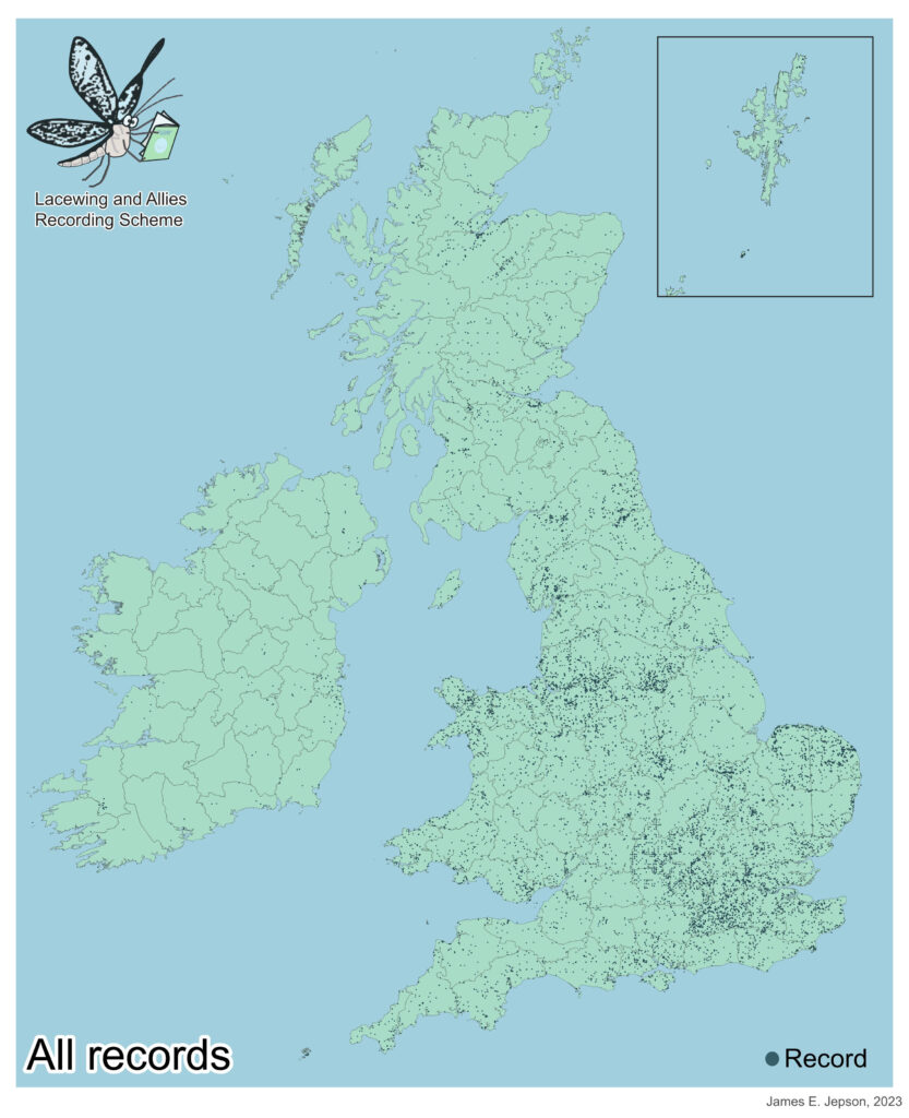
The Lacewing and Allies recording Scheme currently has over 25,000 submitted records from across the British Isles. The following maps show the distribution of the received records – the British Isles is divided up into vice counties, see image below for their names and number.

The map below shows the location of all the records received by the scheme (one dot represents one record), combining all four orders (Neuroptera, Raphidioptera, Megaloptera, Mecoptera). From the map you can see that many of the records received are focused around certain areas with vast areas of the British Isles where we have received few or no records, in particular Scotland and Ireland.

The records for each order are given below.

All maps made using QGIS – QGIS.org (2023). QGIS Geographic Information System. Open Source Geospatial Foundation Project. http://qgis.org
